
Valleys and Singletrack: Three Days of Mountain Biking North of Chiang Mai
Three days of singletrack, rice paddies and limestone views — guided riding through Mae Taeng and Chiang Dao
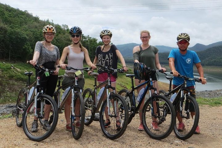
The first pedal stroke feels like an agreement between you and this place. The valley exhales rice-scented humidity; a string of karst ridges holds the sky like a low, patient roof. Your guide — English-speaking, local, and conversational about everything from elephants to irrigation seasons — nudges you downhill and the trail answers: hard-packed dirt, a ribbon of roots, a sudden wash of mango trees. Over three days you move through two distinct moods of northern Thailand: Mae Taeng's pastoral lowlands and Chiang Dao's limestone shoulders. They are close on a map but distant in temper, and the ride stitches them into a coherent, memorable arc.
Trail Wisdom
Hydrate Early and Often
Start each day with 500–750 ml of water and sip consistently; the humid valley air disguises fluid loss.
Minimize Pack Weight
Bring one small daypack with tools, a rain layer and snacks—the tour handles luggage transfers.
Respect Local Customs
When stopping at temples or village homes, dress modestly and follow your guide's lead to avoid cultural missteps.
Ride Within Your Limits
There are technical sections and hike-a-bike pitches; it's fine to dismount and walk—safety over style.
Local Knowledge
Hidden Gems
- •Chiang Dao Cave and its quieter caverns away from main tour stops
- •A rural rice-paddy lookout road near Mae Taeng that offers sunrise panoramas
Wildlife
White-handed gibbons (occasionally heard in forested patches), Lesser whistling ducks and local waterbirds around paddy fields
Conservation Note
Stick to established trails and avoid disturbing rice paddies; choose local guides and accommodations that support community-based tourism to minimize footprint.
These valleys were part of the Lanna cultural sphere; you’ll see Lanna-style temples and terrace agriculture shaped by centuries of irrigated rice farming.
Seasonal Guide
spring
Best for: Greener trails, Fewer tourists
Challenges: Occasional rain showers, Soft ground after storms
Spring (March–May) brings warm days and blooming fields; trails can be soft after rain, so expect some muddy patches.
summer
Best for: Lush scenery, Fruit in season
Challenges: Heavy monsoon rains, Risk of flooded crossings
Summer is monsoon season — dramatic, green and wet; plan for rain, slippery sections and possible route changes.
fall
Best for: Clear views, Comfortable temperatures
Challenges: Cooler mornings, Higher tourist traffic in peak months
Fall (October–November) offers crisp air and clear vistas as the rainy season wanes—ideal riding before the cool season crowds.
winter
Best for: Cool, dry riding, Stable trail conditions
Challenges: Chilly mornings and nights, Limited daylight hours
Winter (December–February) is the best time for firm trails and pleasant riding conditions, though mornings can be cold.
Photographer's Notes
What to Bring
Full-face or Mountain HelmetEssential
Protects against impacts on rough singletrack and provides sun/shade for exposed descents.
Hydration Pack (2–3L)Essential
Keeps water accessible and stores snacks and a light rain shell for sudden showers.
Puncture-Resistant Tires or Tubeless SetupEssential
Reduces flats on mixed gravel and rocky sections common in Chiang Dao and Mae Taeng.
Lightweight Rain Shell
Useful for sudden tropical downpours during the wet season and wind on ridge descents.
Common Questions
Do I need to bring my own bike?
The tour usually provides well-maintained mountain bikes, but check in advance for size availability or upgrades; bringing a personal bike is an option if arranged ahead.
How fit do I need to be for this trip?
Moderate fitness is recommended—able to ride multi-hour days on mixed terrain and climb moderate gradients; the guide adapts pace to group ability.
Are accommodations included?
Yes, two nights in a comfortable boutique countryside hotel are included; the specific property is not named in the tour description.
What happens if it rains?
Guides adjust routes for safety; heavy monsoon conditions may necessitate alternative roads or rescheduling some sections.
Is this suitable for beginners?
Beginners with solid fitness may enjoy it, but expect some hike-a-bike sections; intermediate riders will be most comfortable.
Are meals and water included?
Meals are typically included per the tour itinerary, and guides provide water refills; bring cash for extra snacks or market purchases.
What to Pack
Helmet for protection; Hydration pack for constant fluids; Lightweight rain jacket for sudden tropical showers; Spare inner tube and mini-pump for quick repairs.
Did You Know
Doi Chiang Dao near Chiang Dao is the third-highest peak in Thailand at 2,175 meters and is part of a limestone range that supports rare flora and fauna.
Quick Travel Tips
1) Fly into Chiang Mai International Airport (CNX) and expect a 1–2 hour drive to the countryside base; 2) Carry small Thai baht bills for village purchases; 3) Inform guides of any dietary restrictions in advance; 4) Bring sunscreen and insect repellent for daytime sections.
Local Flavor
After a day on the trail, try khao soi at a village stall or head back to Chiang Mai for Nimmanhaemin’s craft coffee and bars; local night markets are also great places to sample sticky rice desserts and pick up hand-carved souvenirs.
Logistics Snapshot
Closest airport: Chiang Mai International Airport (CNX); Driving distance: ~45–90 minutes from Chiang Mai depending on the route; Cell service: intermittent in remote valleys but solid near towns; Permits: none typically required, but respect temple rules and private land.
Sustainability Note
This region relies on small-scale agriculture and community-based tourism—pack out trash, avoid single-use plastics, and support local food and guides to ensure tourism benefits the valley communities.
Continue Reading

First Waves on the Grand Strand: Surf Lessons in Myrtle Beach
Learn to stand up on your first wave on the Grand Strand. Myrtle Beach’s gentle breaks and experienced instructors make it an ideal place for beginners to get comfortable on a board—and then explore the surf culture that grew around it.
Myrtle Beach, South Carolina

Chasing Cascades: A Half-Day Hike From Asheville to Waterfalls and Wildwoods
In four hours you can move from Asheville's streets into cathedral-like forest and the roar of mountain waterfalls. This guided half-day hike pairs scenic cascades with a certified naturalist to turn scenery into story.
Asheville, North Carolina